Introduction
In this part, we develop the strategy for a geophysical field-work campaign carried out along the surface over a target.
Fieldwork
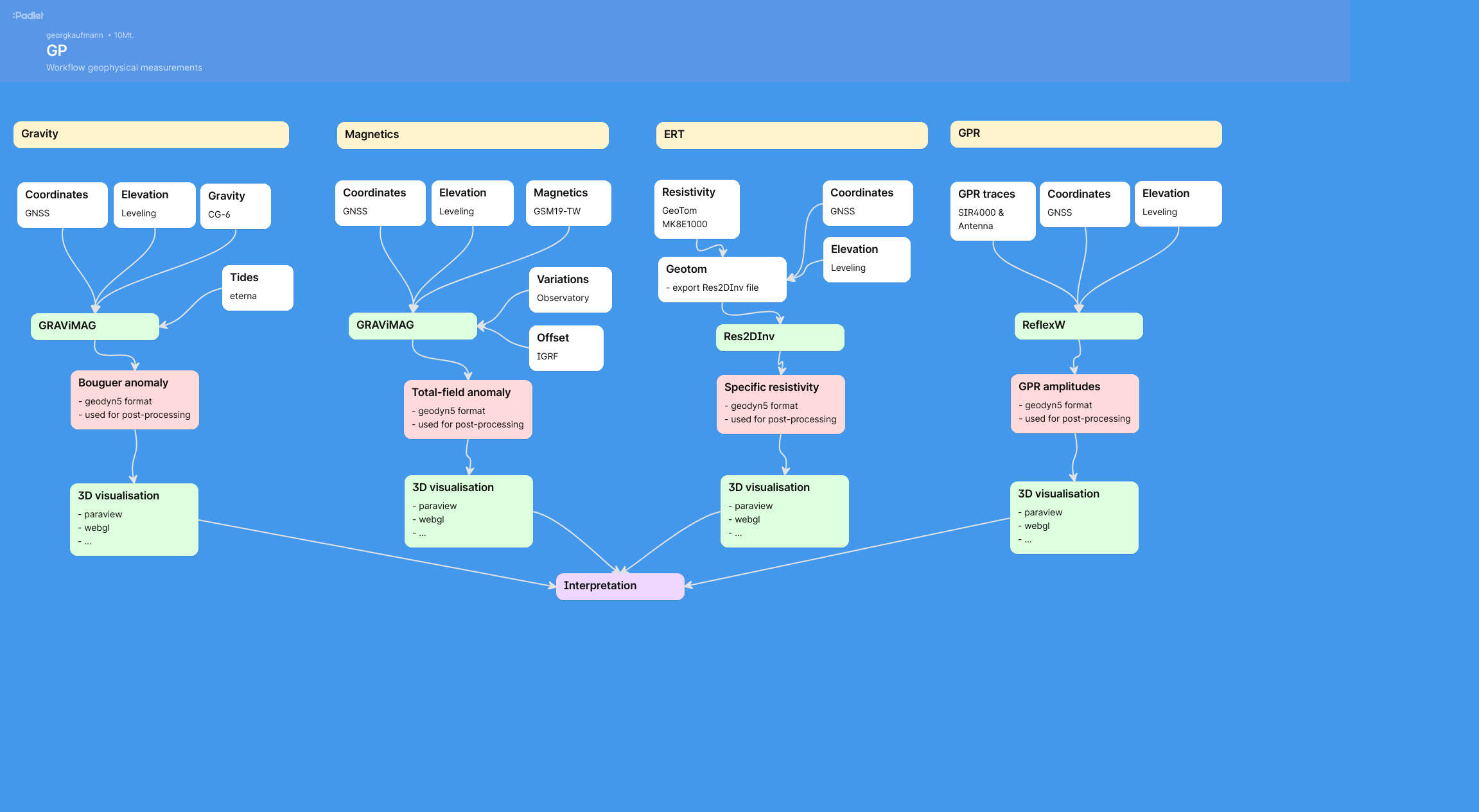
Geophysical fieldwork campaigns utilise different geophysical methods, e.g. gravity, ground-penetrating radar, electrical resistivity tomography, magnetics, …
Each method has its own instrument, its own workflow, its own data export, and its own data export. The challenge in a multi-method campaign is to collect and merge the different data sets and their interpretation.
Additionally, a project is embedded into the context of the field area. Here, additional data such as elevation data, aereal photos, geological maps, are often used to facilitate the interpretation.
It is therefore important to carefully plan the fieldwork campaign.
Project design
We first prepare our project by defining the target area. We recommend:
elevation data, e.g. a digital terrain model (dtm),
digital orthophotos (dop), including their georeferenced coordinates,
geological maps, e.g. as shapefiles.
The digital terrain model will be stored in a special format, the
geodyn5 data format, which is a structured data format in plain
ascii (see chapter geodyn5).
Workflow
Enlarge by right-click and open in new tab …
