Lutz Lesch
History
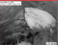
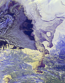
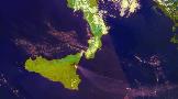
![]() May 1996
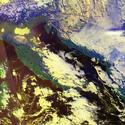
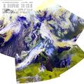
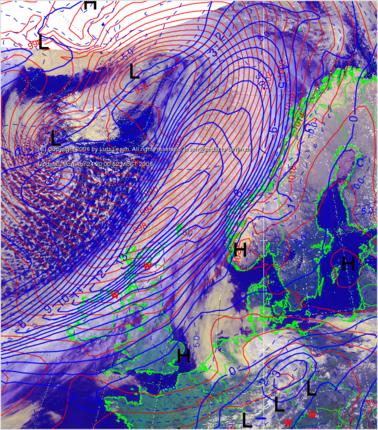
Remarkable air mass boundary over Central Europe
May 1996
Remarkable air mass boundary over Central Europe
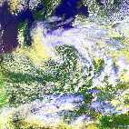
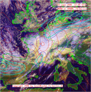
![]() June 1996
June 1996
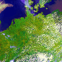
![]() Clear sky over Central Europe (CAVOK)
Clear sky over Central Europe (CAVOK)
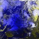
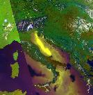
 July 1996
 Low pressure circulation pattern filled with cold air (left) and front related cb/ts (right)
 August 1996
 Initial guess of cyclogenesis
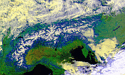
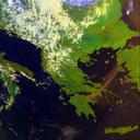
 September 1996
Air flow confluence (south of Baltic Sea)
September 1996
Air flow confluence (south of Baltic Sea)
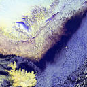
 November 1996
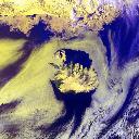
 Cold water streak between Greenland and Iceland
 December 1996
Polar Front Jet Stream (PFJ) over W-Europe
December 1996
Polar Front Jet Stream (PFJ) over W-Europe
 January 1997
Swiss Jura, Black Forest and Vosges push through dense low level stratus
January 1997
Swiss Jura, Black Forest and Vosges push through dense low level stratus
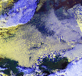
 February 1997
Horizontal eddy streak south of Crete
February 1997
Horizontal eddy streak south of Crete
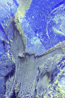
 March 1997
Convergence near the surface and upper air divergence
March 1997
Convergence near the surface and upper air divergence
 April 1997
Closed cellular convection over land
April 1997
Closed cellular convection over land
 June 1997
Cloud cover and masked land-/water surfaces
June 1997
Cloud cover and masked land-/water surfaces
 July 1997
Floods of river Odra
July 1997
Floods of river Odra
 September 1997
Lee effects (south of the scandinavian mountains)
September 1997
Lee effects (south of the scandinavian mountains)
 October 1997
Polar Low
October 1997
Polar Low
 December 1997
Nowaya Zemlya Lee Waves
December 1997
Nowaya Zemlya Lee Waves
Fast moving coldfront crossing Northern Europe
 March 1998
Topographic forceed air flow pattern
March 1998
Topographic forceed air flow pattern
 November 1998
The Alps (CAVOK)
November 1998
The Alps (CAVOK)
 December 1998
Low level inversion and internal gravity waves (cisalpin)
December 1998
Low level inversion and internal gravity waves (cisalpin)
 January 1999
Cold air mass (ST -30 C) over BALTIC SEA
January 1999
Cold air mass (ST -30 C) over BALTIC SEA
 March 1999
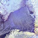
Pack-Ice at BARENTS SEA
March 1999
Pack-Ice at BARENTS SEA
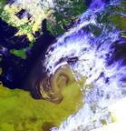
 May 1999
Extratropical cyclone NOEL
May 1999
Extratropical cyclone NOEL
 July 1999
Europe and cisalpine cumulus humilis/mediocris
July 1999
Europe and cisalpine cumulus humilis/mediocris
 August 1999
Solar Eclipse over Europe
August 1999
Solar Eclipse over Europe
 November 1999
BORA
November 1999
BORA
 April 2000
ICELAND
April 2000
ICELAND
 June 2000
sun glint cis- and transalpine
June 2000
sun glint cis- and transalpine
 July 2000
Forest Fires at GREECE and TURKEY
July 2000
Forest Fires at GREECE and TURKEY
 October 2000
First NOAA-16 / AVHRR images
October 2000
First NOAA-16 / AVHRR images
 January 2001
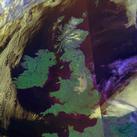
Ireland and UK "prob90" cavok
January 2001
Ireland and UK "prob90" cavok
 March 2001
Polar air mass cut off in connection with different sea surfaces
 May 2001
Extratropical cyclone and East Mediterranean sandstorm
 July 2001
"Etna" volcanic eruption
 March 2002
GREENLAND, Sea Ice and Karman Vortex
 August 2002
Upper level quasi-horizontal velocity divergence
and surface precipitation in northeast Germany
Divergence Equation
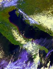 March 2003
Accumulation of sediments at the Adriatic coastline of Italy
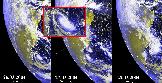
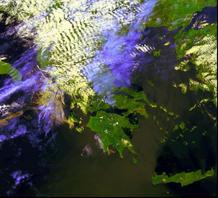
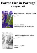 August 2003
Forest Fires in Portugal
 March 2004
Hurricane (?) Catarina
 April 2004
Topography forces low-level vane of sandstorm crossing the MEDITERRANEAN SEA
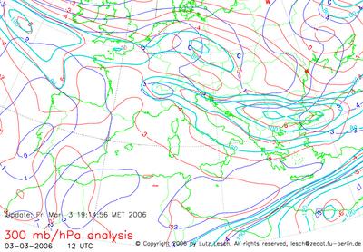 March 2006
300 hPA Dynamicborne centers of horizontal Divergence of v(h)
at two POLAR FRONT JETSTREAM catchment areas
(dark blue lines, values .GT. 3.0 x 10E-5 [secE-1])
above BeNeLux and Switzerland
force intensive vertical upward motion and precipitation
3 March 2006, 12:00 UTC
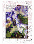
 April 2006
Coincidence of operational computed NOWCAST MSL precipitation area
(EM grid, blue line, mm/6h) and
spaceborne NOAA AVHRR detected cloud patterns (superimposed)
22 April 2006, 12:00 UTC
 October 2006
Remarkable divergence of v(h) at level 300 hPa (red lines)
and less advection of pos. rel. vorticity (blue lines)
in close vicinity to the right behind quadrant
of the Polarfront Jet core (catchment area) above E-France
force heavy upward motion with strong precipitation
03 October 2006, 12:00 UTC
![]()
![]() July 2007
July 2007
Cirrus patterns visualize
heavy upper air horizontal ageostrophic air motion v[h,a] (300 hPa)
in close vicinity to Polarfront Jet Core (PFJ) axis and Delta
(cross circulation northeastwards, normal and upstream accelerating)
03 July 2007, 12:00 UTC
Special Issue
(case studies to actual remote sensing related phenomenons):
![]() Iceland volcano,3 October 1996
Iceland volcano,3 October 1996
 Iceland volcano,4 October 1996

Creation Date: November 2, 1996
Last Modification: June 21st, 2000
© Free University of Berlin, Institute of Meteorology,
Section of Remote Sensing
directory up
![]() Homepage server:
userpage.FU-Berlin.DE/~lesch/
Homepage server:
userpage.FU-Berlin.DE/~lesch/
maintained by lutz.lesch@FU-Berlin.DE
Lesch